


This web page is created within BALTICS project funded from the European Union’s Horizon2020 Research and Innovation Programme under grant agreement No.692257.
Experience
Experiences and demonstration examples
The experience of the department in data processing and implementation of various tasks is summarized in the table. Some of the automated data products are available on the website talizpete.venta.lv.
The research results are demonstrated in a popular scientific way on Youtube channel VIRAC Remote Sensing -here.
The experience of the department in data processing and implementation of various tasks is summarized in the table below.
Processed data
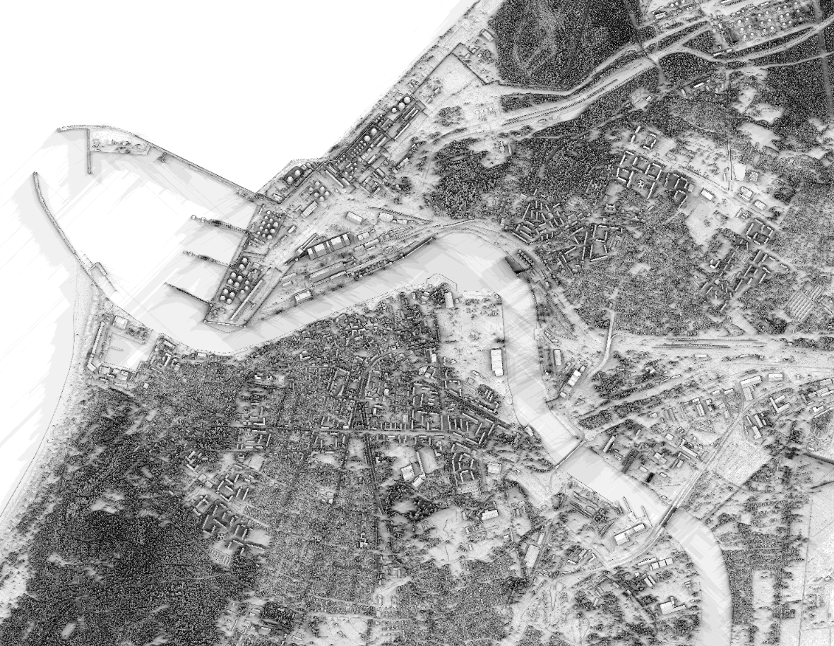
- Countrywide orthophoto maps
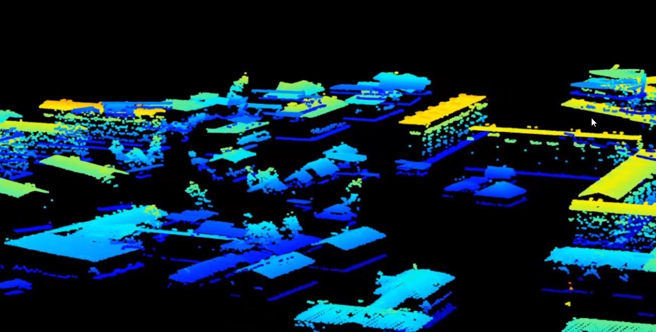
- Countrywide LiDAR data
- Copernicus program data
- Landsat program data
Development and data analysis environments,
technical support
- Python (with support of various libraries: gdal, keras, tensorflow, opencv, scikit-image, scikit-learn)
- QGIS
- Angular, JavaScript, Node.js, Cesium
- CPU: 2 x Intel Xeon Gold 6240 (18 cores each),
- RAM: 384GB DDR4 2933Mhz,
- 2 x 256GB SSD,
- GPU: 2 x NVIDIA,Tesla V100, 16GB HBM2.
Realized tasks
- Land cover / use mapping in remote sensing data from various sources
- Building mapping
- Reconstruction of 3D models of buildings
- Detection of individual trees
- Shadow mapping
- Identification of tree species
- Forest standing volume and biomass assessments
Developed methods and workflows
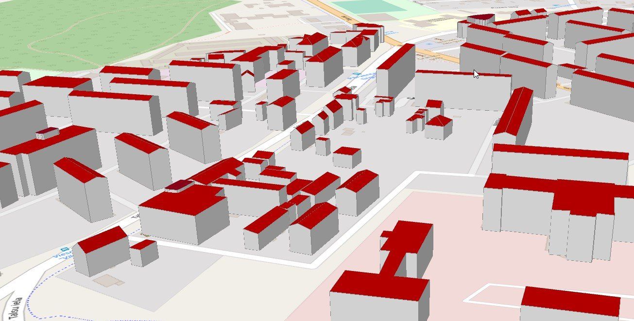
Reconstruction of 3D models of buildings using countrywide data
Creating 3D models of buildings using unmanned aerial vehicle data is a time-consuming and financially expensive process. Countrywide LiDAR data are freely available, but their low point density poses many challenges in the implementation of the methods. The purpose of the automated methods is to recognize individual roof planes in the LiDAR point cloud and to design a 3D model of the building so that it is compatible with other solutions, such as OpenStreetMap.
The remote sensing department has developed a workflow that reconstructs 3D models of buildings of various complexity and examples can be viewed here
Determining the contours of buildings
Remote sensing data, which are available at the national level and their processing methods, allow automated creation of building contour maps, which both allows to detect changes in construction and facilitates the map renewal process. Acquisition of building contours can be realized using various methods, but following modern trends in the field of image processing, convolutional neural networks were used for the realization of the task. Convolutional neural networks are a relatively new concept that requires specific data generation and specialized hardware as a high-performance computing cluster node, which, for neural network training, is typically equipped with multiple high-performance GPUs (graphics processing units).
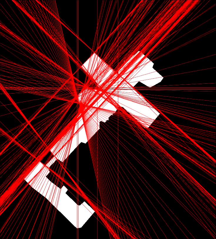
Shadow mapping
There is an increasing emphasis in the world on 'green thinking', which means using alternative energy sources in the context of electricity generation. Solar panel systems are already widely used, but the efficiency of these systems can be significantly affected by shadows. Derivative LiDAR data products are widely used in remote sensing calculations. The calculation of the shadow projection is performed using the exact determination of the position of the Sun in combination with a digital surface model obtained from LiDAR data. Shadow projection maps are useful not only for finding the optimal location for installing solar panels, but also for planning the urban environment in general. For examples of shadow maps, see here.